
Travel to Niger: Sahara, giraffes and mud-brick cities
A river that gives the country its name, golden dunes, one of the last herds of West African giraffes and caravan cities built of earth: Niger is a country of desert and memory, to discover when conditions allow. Here is some background before you look at flights to Niger.
Before reading further: many governments advise against or restrict travel to Niger, and the situation can change. Check the official advice of your country of departure before considering any trip; this page only presents cultural and natural landmarks.
Niger at a glance
Capital
Niamey
Area
About 1.27 million km²
Currency
CFA franc
Languages
Hausa, Zarma and others
Highest point
Idoukal-n-Taghès
Sahara
Over 80%
Continent
Africa
Time zone
UTC+1
Airports covered
1
Why it fascinates
A vast desert, a river and cities of earth
The Sahara and the Aïr massif
Dunes, black rock plateaus and the Aïr massif, rising to about 2,000 m: the Aïr and Ténéré reserve covers around 84,000 km².
Agadez, caravan city
At a crossroads of Saharan tracks, the historic centre of Agadez, a UNESCO site since 2013, has eleven quarters of mud-brick houses.
The giraffes of Kouré
About 60 km from Niamey, the Kouré area shelters one of the last herds of West African giraffes.
A river, many cultures
Hausa, Zarma, Tuareg, Fulani, Kanuri: Niger's peoples make a mosaic of architecture, festivals and craft.
Highlights
Niamey, Kouré, Agadez, Zinder and the Sahara dunes
These are the places that give Niger its reputation for heritage, wildlife and landscape. They are presented as cultural information, landmarks to discover when conditions allow; this page offers no itinerary and no on-the-ground advice.
Niamey, the river and the dunes
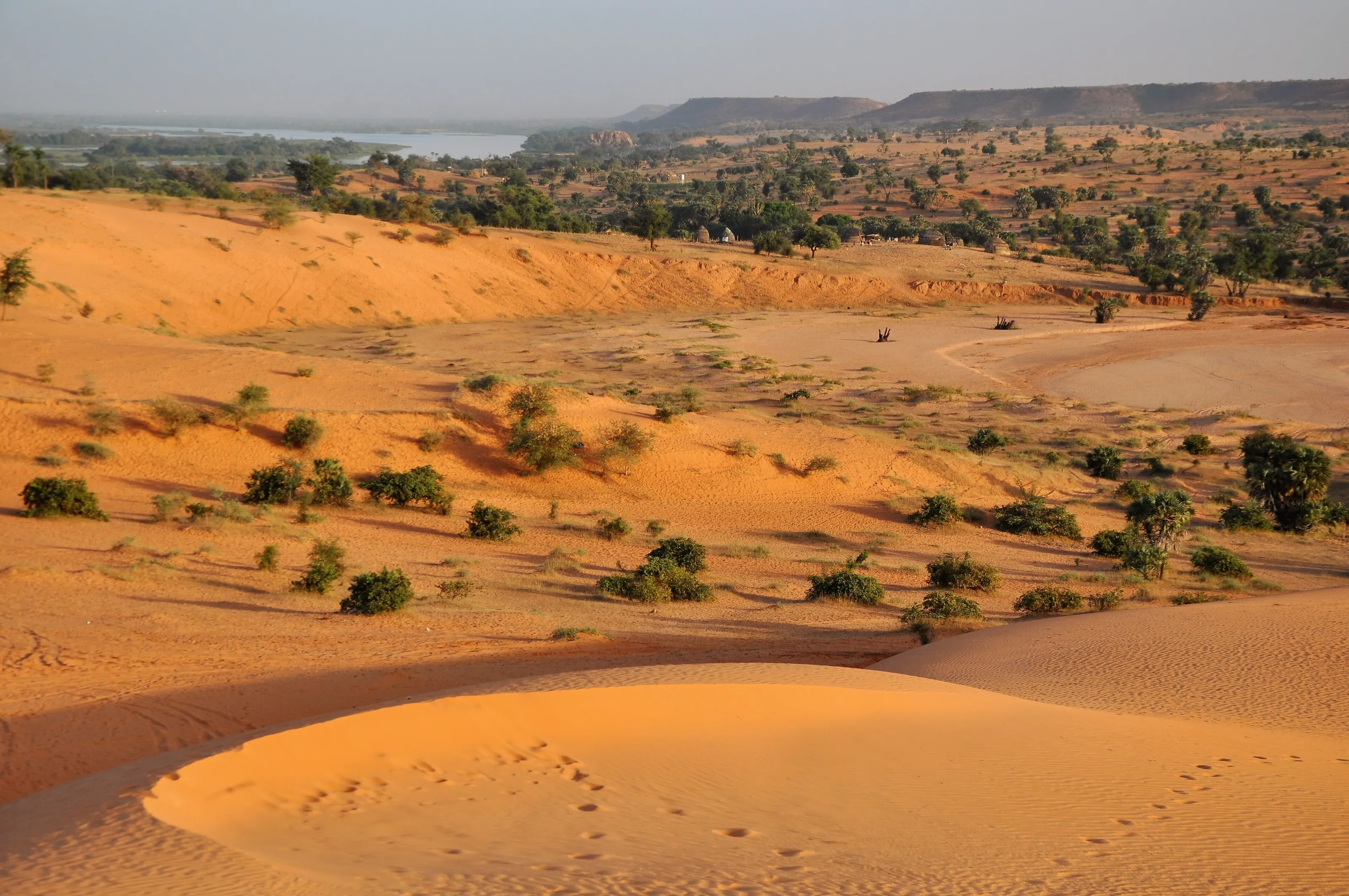
The capital sits on the Niger River, which runs for about 650 km through the country, and is also its largest city. Around it, shrubby savanna alternates with orange sand dunes overlooking the river: in the evening light the view is one of the gentlest in the country. The National Museum, its craftspeople and the big market complete the picture of a river city.
Kouré and the West African giraffes
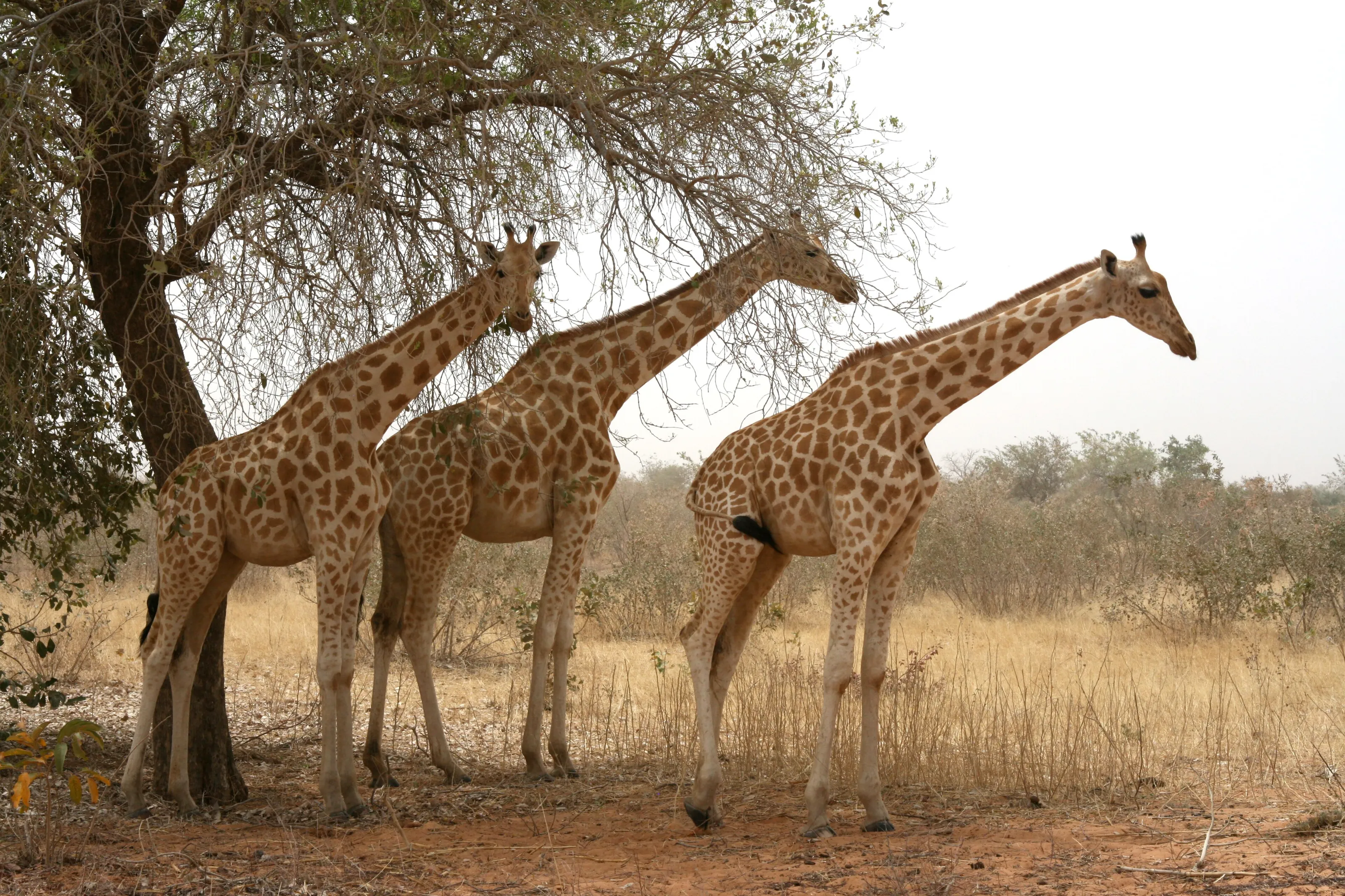
About 60 km from Niamey, the village of Kouré is known for its giraffes, described as the last free herd in West Africa. These giraffes, paler with larger orange patches, live in a wooded savanna where they feed on acacia. Wildlife presence depends on the seasons and on how the area is protected.
Agadez, the mud-brick city of the Sahara
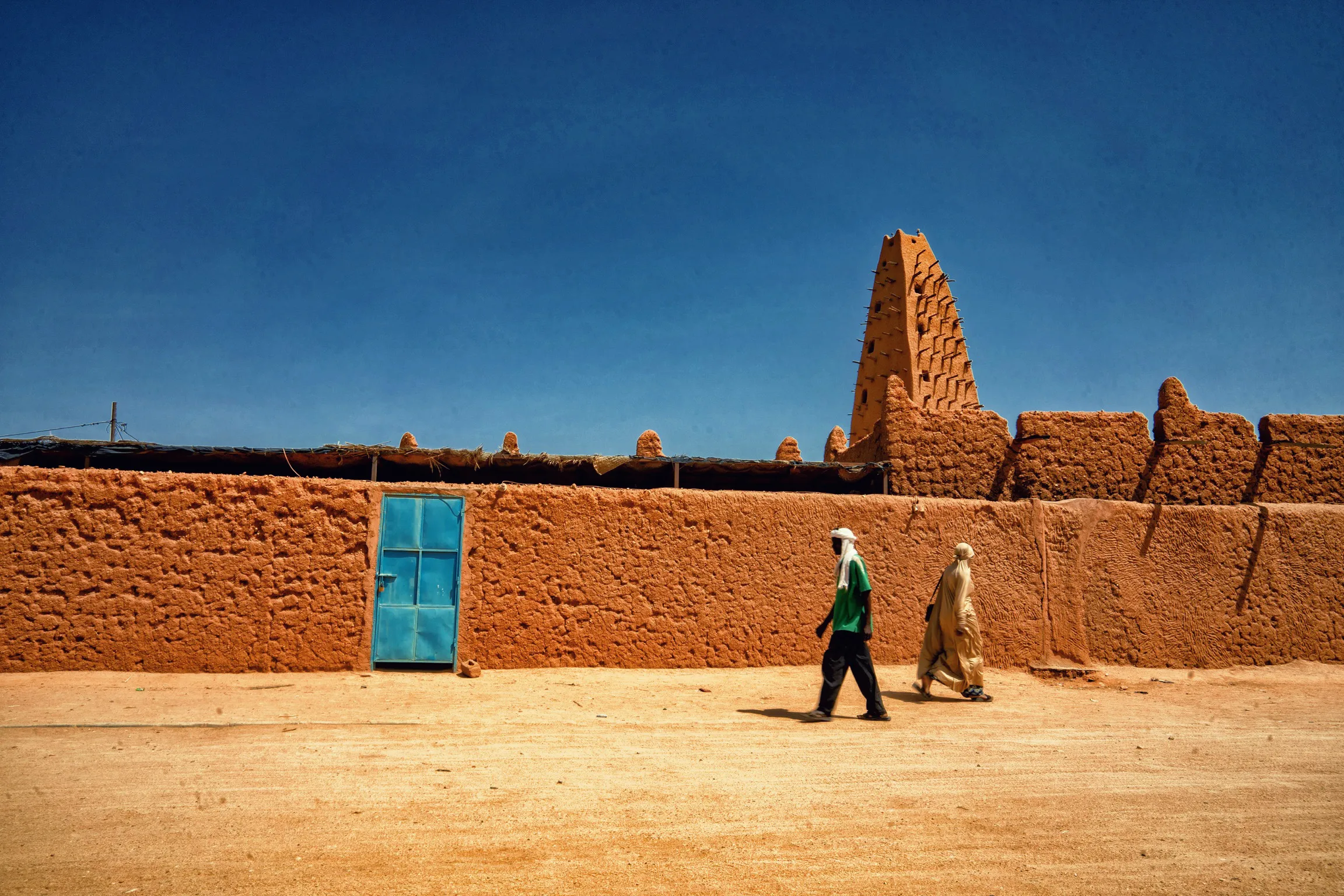
At the gates of the Aïr, Agadez grew in the 15th and 16th centuries as the capital of a sultanate and a caravan crossroads. Its historic centre, a UNESCO site since 2013, has eleven quarters whose streets follow old encampment lines. The minaret of the Grand Mosque, about 27 metres of mud brick, is described as one of the tallest structures of its kind in the world, with wooden beams jutting from its walls.
Zinder, the old Hausa town
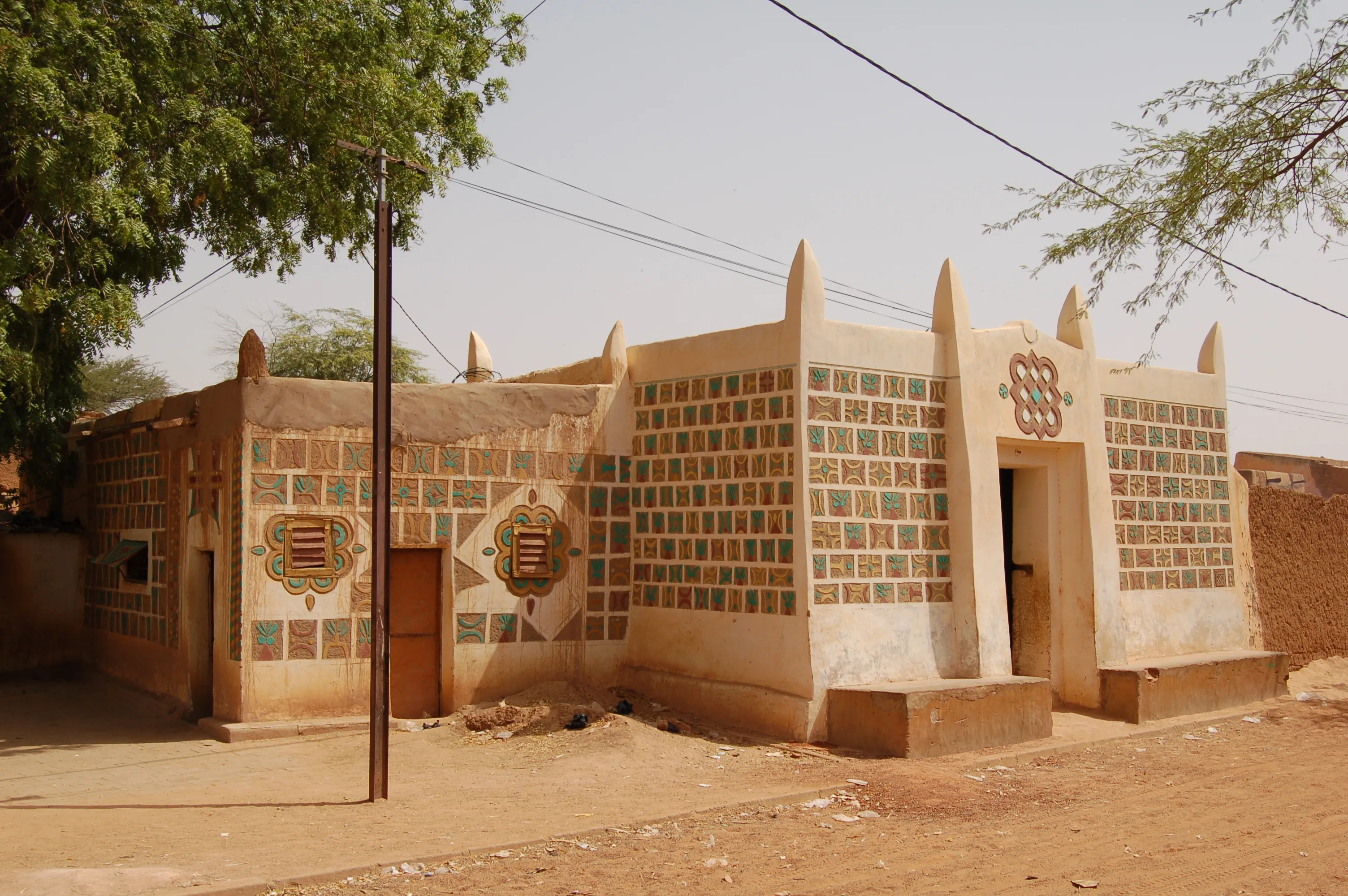
The country's second city, Zinder was the capital of the Sultanate of Damagaram from 1812. The fortified Birni quarter keeps houses with mud-brick facades decorated with geometric motifs and painted reliefs, typical of Hausa architecture. These decorations, in earth, turquoise and ochre tones, are worth a look in themselves.
The dunes of the Aïr and Ténéré
North of Agadez, the Aïr massif, a triangle of rock rising above 2,000 m, opens eastward onto the dunes of the Ténéré. Together they form one of the largest protected areas in Africa, a UNESCO site, with more than 400 plant species recorded in the Aïr. These are landscapes of rare immensity.
Before you go
Dry heat, rainy season and harmattan: the climate of Niger
| Area | Climate | Period often cited |
|---|---|---|
| Niamey and the south-west | Sudano-Sahelian: rain from June to October (about 400 to 700 mm), strong heat all year, averages of 32 to 34 C in June. | November to February, drier and milder |
| Kouré and the river | Same seasonal rhythm; green savanna in the rainy season, drier afterwards. | Dry season |
| Agadez and the Aïr | Desert: almost no rain, very hot days in spring and summer, cool winter nights. | November to February |
| Zinder and the centre | Sahelian: about 400 mm of rain a year, marked heat. | November to February |
Many governments advise against or restrict travel to Niger. These climate notes are cultural information only; check your departure country's official advice before considering any trip, and follow it. Entry requirements vary by nationality.
Getting around
A landlocked country of great distances
Niger has no coastline and covers about 1.27 million km2, much of it in the Sahara. Travel conditions change and depend on decisions that only the official sources of your country of departure can reliably communicate.
This page offers no itinerary and no on-the-ground advice. It presents the country for what is most precious about it: its built heritage, landscapes and culture, to discover when conditions allow.
Culture and food
Millet, rice, dambou and Tuareg tea
Nigerien cooking rests on millet, rice, sorghum and maize, served with sauces and grilled meat. Dambou, a grain couscous mixed with moringa leaves, and street fritters are among the most often mentioned specialities.
The country's cultures are many: Tuareg jewellery and songs, Fulani festivals, Hausa decorative art. Tea, prepared and served in several glasses, sets the rhythm of gatherings in the north.
Travel to Niger
The Nigerien airport tracked by SniperAir
Diori Hamani International
The airport of Niamey, the capital, about ten kilometres from the centre. Some services may be suspended or limited: check the situation before any booking.
FAQ
Frequently asked questions about flights to Niger
Which airport for a flight to Niger?
SniperAir tracks Niamey (NIM). Some services may be suspended or limited: check with airlines and the authorities before any booking. Other cities have their own airports, not covered.
When is the best time to travel to Niger?
November to February is often cited as the driest and mildest period; rain falls from June to October in the south. These are only climate notes.
Is travelling to Niger expensive?
The budget depends on many factors, and the flight is often a large share. We give no prices or estimates: conditions can change and fares vary widely.
Do I need a visa for Niger?
A visa is generally required, but conditions vary by nationality and can change. Ask the competent authorities and check the official website of your country of departure.
How long should I plan for?
The length depends entirely on conditions at the time, and SniperAir offers no itinerary. Distances are long; the answer belongs with official sources.
What should I know before going?
Many governments advise against or restrict travel to Niger, and the situation can change. Check the official advice of your country of departure before considering any trip. This page is cultural information: it does not recommend travelling.
How do I get alerted when a flight to Niger changes price?
SniperAir monitors flight prices and sends alerts; we do not sell or book any ticket. Create an alert profile with your departure airport if you follow this destination. See how it works.
Follow flight prices to Niger?
Create an alert and let SniperAir do the rest.
Create my alert