
Travel to Tajikistan
Turquoise lakes perched in the mountains, the legendary Pamir Highway, giant glaciers and Persian culture in the heart of Central Asia: that is the Tajikistan worth dreaming about before you look for cheap flights to Tajikistan.
Tajikistan in numbers
Capital
Dushanbe
Population
About 10 M
Area
About 143,000 sq km
Currency
Somoni
Languages
Tajik
Highest point
Ismoil Somoni Peak
Continent
Asia
Time zone
UTC+5
Airports covered
1
Why visit Tajikistan
Alpine lakes, the Pamir Highway, the Fann Mountains and Persian culture
Turquoise lakes in the heights
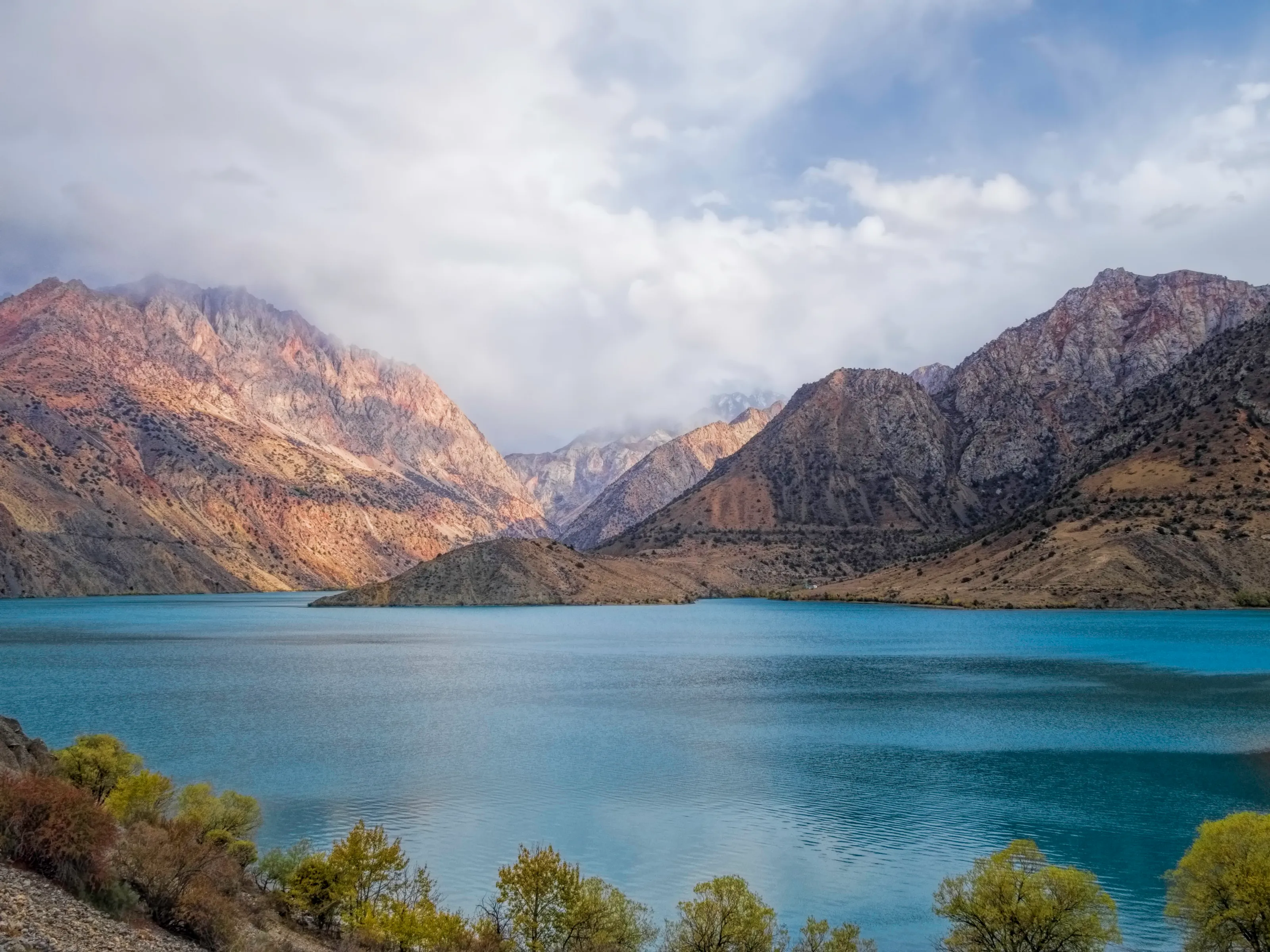
Iskanderkul, the Kulikalon lakes, the Seven Lakes valley: in the Fann Mountains the water takes on unreal tints at the foot of red and ochre rock walls.
The Pamir Highway
From Khorog to Osh, the Pamir Highway strings together passes of 3,200 to 4,500 m, the Wakhan Valley and the high plateau, one of the world's great road journeys.
The roof of the world without the crowds
More than half the country lies above 3,000 m. Treks, mountain villages and glaciers can be found away from the busy routes of Nepal or Pakistan.
Persian culture and Silk Road roads
Food shared from a common dish, tea houses, brick fortresses, the proto-urban site of Sarazm: history can be read at every stage.
Highlights
Iskanderkul, the Fann Mountains, the Pamirs and Dushanbe
A trip to Tajikistan is built around Dushanbe, the capital, from where you head to the more accessible Fann Mountains and Iskanderkul, or to the Pamirs for a longer expedition. The mountain season runs from June to September.
Iskanderkul and the Fann Mountains
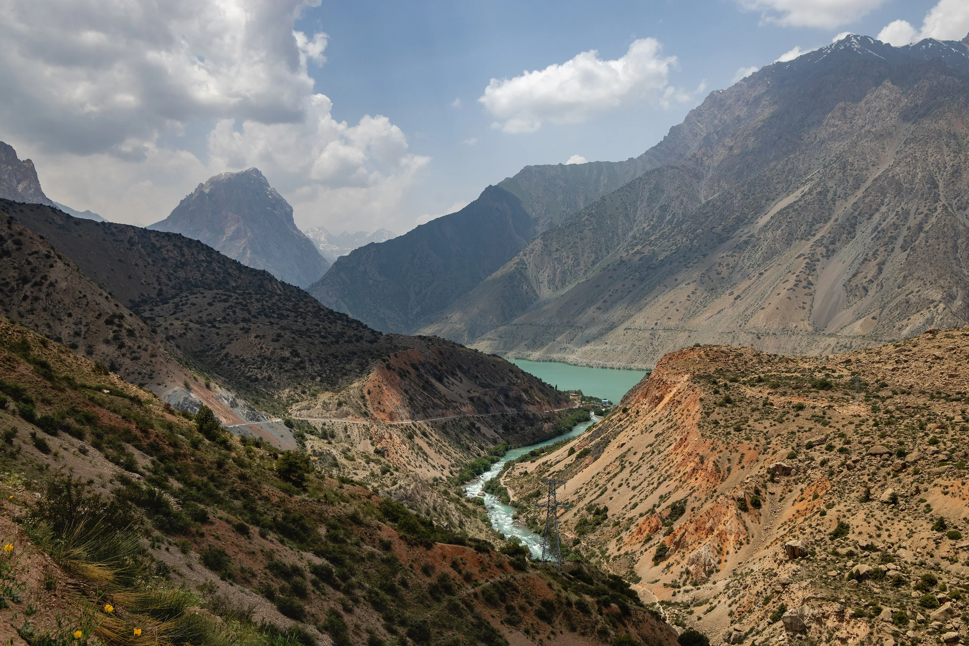
At about 2,200 m, Iskanderkul is a turquoise mountain lake ringed by rocky peaks. The valley leading to it, carved by a glacial river, already offers spectacular scenery, and a waterfall lies nearby. It is one of the easiest excursions to arrange from Dushanbe, in one or two days.
The Kulikalon lakes and the Seven Lakes valley
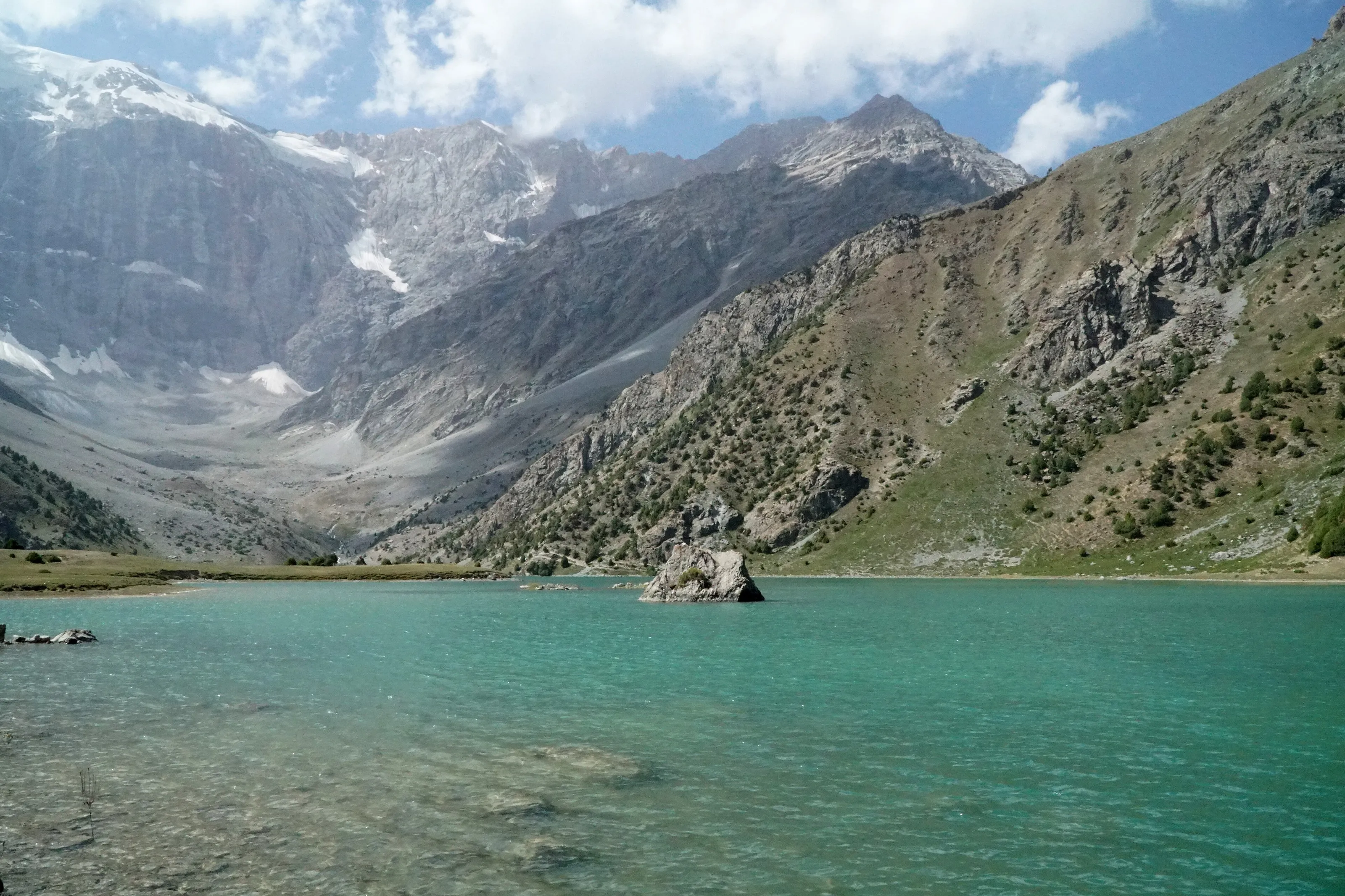
From the Iskanderkul valley, a trek of a few days leads to the Kulikalon lakes, nestled beneath glaciers. Further west, near Panjakent, the Seven Lakes valley lines up bodies of water in different colours, linked by trails and villages. These hikes are a more accessible alternative to the Pamirs.
The Pamirs and the high road
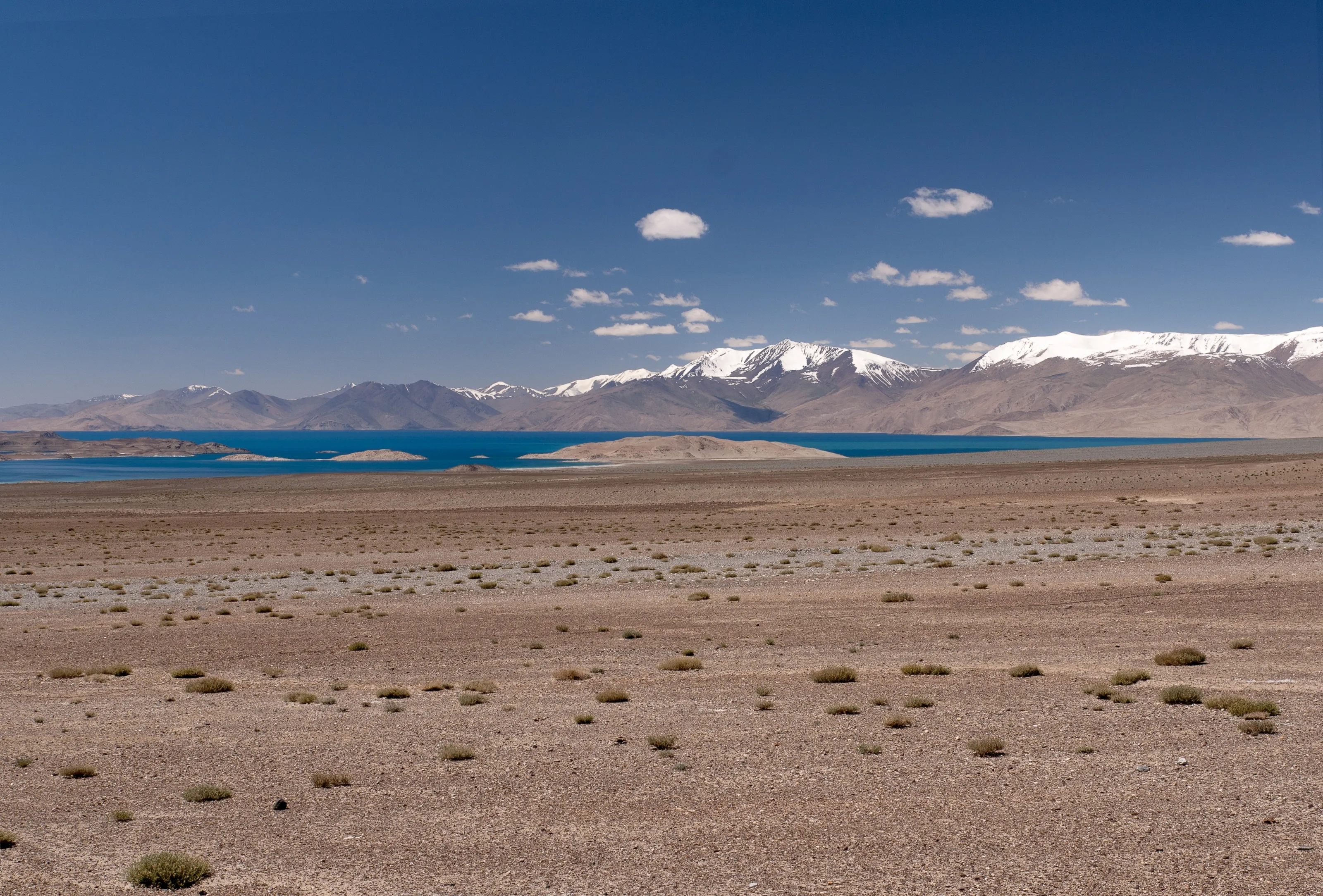
The Pamirs, in the east, are the great meeting point for adventure travellers: passes, plateaus, intensely blue lakes and snowy peaks. Lake Karakul, at nearly 4,000 m, appears along the way. A special permit is needed for Gorno-Badakhshan in addition to the visa; plan on a 4x4 with a driver and time to acclimatise.
Dushanbe and Hissar Fortress
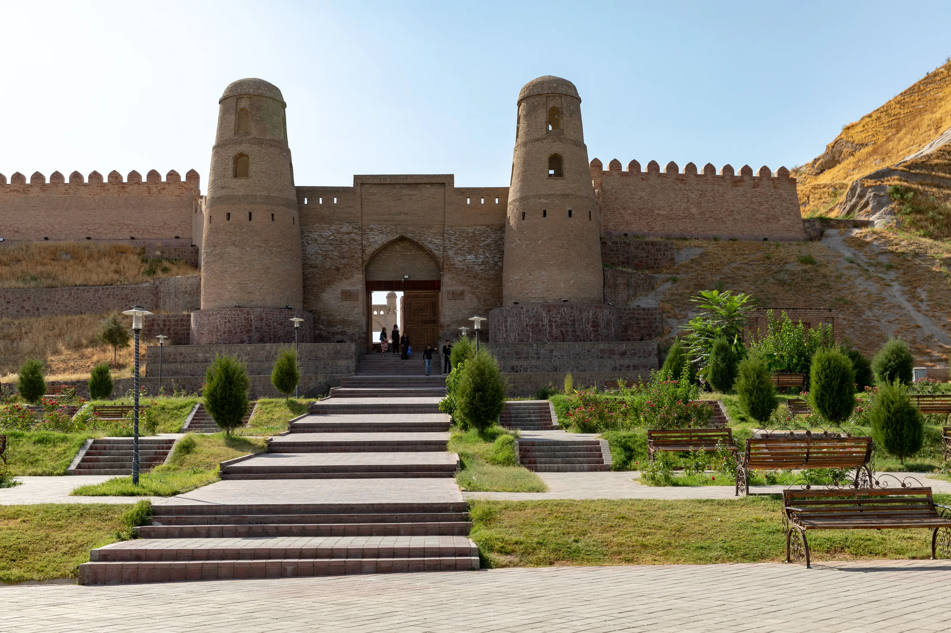
The capital has wide avenues, parks, a national museum and the green bazaar. About thirty kilometres to the west, Hissar Fortress shows its monumental brick gate flanked by two round towers. A half-day visit nicely complements a stay in the mountains.
Panjakent, Sarazm and the Silk Road
In the north, Panjakent is the starting point for the Fann Mountains and holds the remains of an ancient Sogdian city. Close by, Sarazm is a proto-urban site on the UNESCO list. Istaravshan and Khujand complete a circuit in the footsteps of the caravans.
Before you go
Late May to September for the mountains
| Area | Climate | Best time |
|---|---|---|
| Dushanbe | Very hot summers, 35 C and above; cold winters. | April, May, September and October |
| Fann Mountains and Iskanderkul | Mountain: mild days, cool nights, early snow at altitude. | June to September |
| The Pamirs | High altitude, very cold nights even in summer, roads sometimes closed by snow. | June to September |
| Panjakent and the north | Continental, hot in summer. | May to September |
The climate is continental, from semi-arid in the lowlands to polar at altitude: pack warm layers even in summer. Entry conditions depend on your nationality; check the official information from your home country before fixing dates. Watch prices to aim for July and August, which are in demand.
Getting around
Shared taxis, minibuses and 4x4 with a driver
Between cities, minibuses and shared taxis are the usual solution, often charged per seat. In town, marshrutkas serve fixed lines. For the lakes, the Pamirs and remote valleys, a 4x4 with a driver is the safest choice.
Mountain roads are long and can be cut by snow or rockfalls: keep slack in your schedule, and plan at least a day of acclimatisation before going above 3,000 m.
Food and culture
Plov, qurutob, laghman and tea houses
The emblematic dish is osh, or plov, rice with mutton and carrots. Qurutob, a mix of bread, vegetables and dried-cheese sauce, is regarded as the national dish. You will also try laghman, sambusas, skewers and flat bread, with green tea in the tea houses.
Hospitality is a strong value: a shared dish is common and you will gladly be offered tea. A few words of Tajik or Russian are much appreciated.
Travel to Tajikistan
The Tajik airport covered by SniperAir
Dushanbe International
The airport of Dushanbe, a few kilometres from the centre: allow ten to twenty minutes by road. The country's main gateway, it is the starting point for the Fann Mountains and the Pamirs.
FAQ
Frequently asked questions about Tajikistan
Which airport should I use to travel to Tajikistan?
Dushanbe International (DYU), a few kilometres from the centre of the capital. It is the country's main gateway, and SniperAir tracks this airport.
What is the best time to travel to Tajikistan?
Late May to September for the mountains, lakes and the Pamirs. April, May, September and October suit Dushanbe better, which is very hot in summer.
Is travelling to Tajikistan expensive?
On the ground the budget stays fairly moderate, with affordable simple meals and lodging; the heaviest cost is often the flight, followed by a 4x4 with a driver for remote valleys.
Do I need a visa for Tajikistan?
It depends on your nationality: some travellers get a short stay without a visa and an e-visa exists for many others. An extra permit is needed for the Pamirs. Check the conditions with Tajik authorities and your home country's official website.
How long should I plan for a trip to Tajikistan?
Ten to fourteen days let you see Dushanbe, the Fann Mountains and begin the Pamirs. For the full Pamir Highway, plan two to three weeks.
What travel precautions should I take?
Take insurance that covers mountain travel, acclimatise to altitude and read your foreign ministry's travel advice, especially for the Pamirs and areas near the Afghan border.
How can I get alerted when a flight to Tajikistan gets cheaper?
Create a SniperAir alert profile with your departure airport and Dushanbe as the destination: we track prices and let you know as soon as an interesting offer appears. See how it works.
Ready to track prices to Tajikistan?
Create an alert and let SniperAir do the rest.
Create my alert